For habitats listed with a ** symbol, additional photographs of the habitat can be found in separate photographic galleries.
Habitat - Fossitt Irish Habitat Type Classification, Heritage Council
View fullsize
![BC1 Arable crops]()

BC1 Arable crops
View fullsize
![BC2 Horticultural land]()

BC2 Horticultural land
View fullsize
![BC3 Tilled land]()

BC3 Tilled land
View fullsize
![BC4 Flower beds and borders]()

BC4 Flower beds and borders
View fullsize
![BL1 Stone walls and other stonework]()

BL1 Stone walls and other stonework
View fullsize
![BL1 Stone walls and other stonework]()

BL1 Stone walls and other stonework
View fullsize
![BL1 Stone walls and other stonework]()

BL1 Stone walls and other stonework
View fullsize
![BL2 Earth banks]()

BL2 Earth banks
View fullsize
![BL3 Buildings and artificial surfaces]()

BL3 Buildings and artificial surfaces
View fullsize
![CB1 Shingle and gravel banks]()

CB1 Shingle and gravel banks
View fullsize
![CB1 Shingle and gravel banks]()

CB1 Shingle and gravel banks
View fullsize
![CB1 Shingle and gravel banks]()

CB1 Shingle and gravel banks
View fullsize
![CC1 Sea walls, piers and jetties]()

CC1 Sea walls, piers and jetties
View fullsize
![CD1 Embryonic dunes]()

CD1 Embryonic dunes
View fullsize
![CD2 Marram dunes]()

CD2 Marram dunes
View fullsize
![CD3 Fixed dunes]()

CD3 Fixed dunes
View fullsize
![CD4 Dune scrub and woodland]()

CD4 Dune scrub and woodland
View fullsize
![CD5 Dune slacks]()

CD5 Dune slacks
View fullsize
![CM1 Lower salt marsh]()

CM1 Lower salt marsh
View fullsize
![CM2 Upper salt marsh]()

CM2 Upper salt marsh
View fullsize
![CW1 Lagoons and saline lakes]()

CW1 Lagoons and saline lakes
View fullsize
![CW1 Lagoons and saline lakes]()

CW1 Lagoons and saline lakes
View fullsize
![CW2 Tidal rivers]()
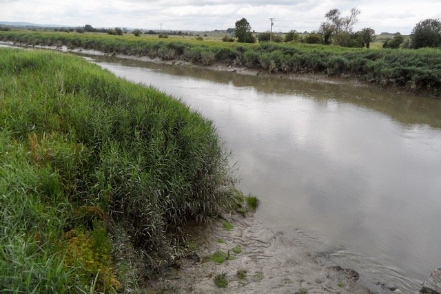
CW2 Tidal rivers
View fullsize
![CW2 Tidal rivers]()

CW2 Tidal rivers
View fullsize
![CS1 Rocky sea cliffs]()

CS1 Rocky sea cliffs
View fullsize
![CS1 Rocky sea cliffs]()
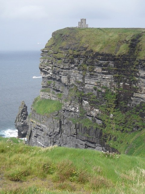
CS1 Rocky sea cliffs
View fullsize
![CS1 Rocky sea cliffs]()
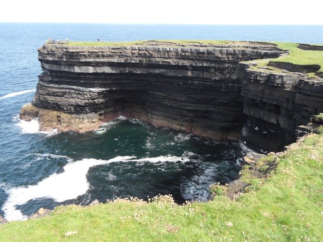
CS1 Rocky sea cliffs
View fullsize
![CS3 Sedimentary sea cliffs]()

CS3 Sedimentary sea cliffs
View fullsize
![CS3 Sedimentary sea cliffs]()

CS3 Sedimentary sea cliffs
View fullsize
![ED1 Exposed sand, gravel or till]()

ED1 Exposed sand, gravel or till
View fullsize
![ED1 Exposed sand, gravel or till]()

ED1 Exposed sand, gravel or till
View fullsize
![ED2 Spoil and bare ground]()

ED2 Spoil and bare ground
View fullsize
![ED3 Recolonising bare ground]()

ED3 Recolonising bare ground
View fullsize
![ED3 Recolonising bare ground]()
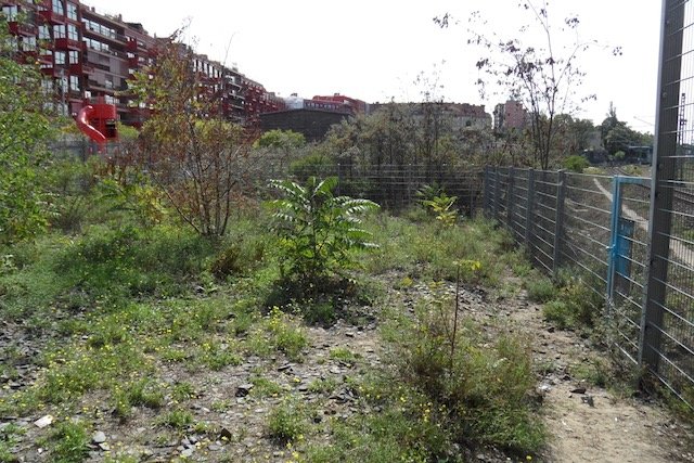
ED3 Recolonising bare ground
View fullsize
![ED3 Recolonising bare ground]()
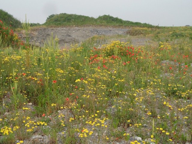
ED3 Recolonising bare ground
View fullsize
![ED4 Active quarries and mines]()

ED4 Active quarries and mines
View fullsize
![ED4 Active quarries and mines]()
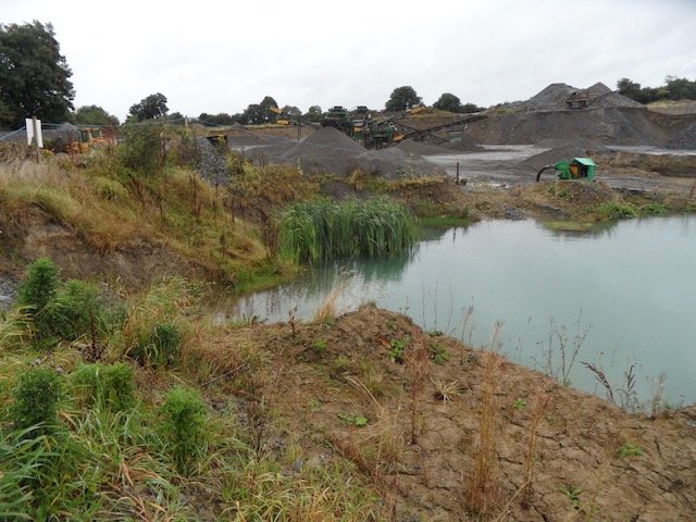
ED4 Active quarries and mines
View fullsize
![ED5 Refuse and other waste]()

ED5 Refuse and other waste
View fullsize
![ER1 Exposed siliceous rock]()

ER1 Exposed siliceous rock
View fullsize
![ER1 Exposed siliceous rock]()

ER1 Exposed siliceous rock
View fullsize
![ER2 Exposed calcareous rock]()

ER2 Exposed calcareous rock
View fullsize
![ER2 Exposed calcareous rock]()
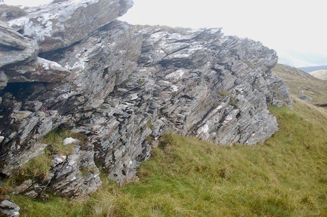
ER2 Exposed calcareous rock
View fullsize
![ER4 Calcareous scree and loose rock]()

ER4 Calcareous scree and loose rock
View fullsize
![ER4 Calcareous scree and loose rock]()

ER4 Calcareous scree and loose rock
View fullsize
![EU2 Artificial underground habitats]()

EU2 Artificial underground habitats
View fullsize
![EU2 Artificial underground habitats]()

EU2 Artificial underground habitats
View fullsize
![FL1 Dystrophic lakes]()

FL1 Dystrophic lakes
View fullsize
![FL1 Dystrophic lakes]()

FL1 Dystrophic lakes
View fullsize
![FL2 Acid oligotrophic lakes]()

FL2 Acid oligotrophic lakes
View fullsize
![FL2 Acid oligotrophic lakes]()

FL2 Acid oligotrophic lakes
View fullsize
![FL3 Limestone/marl lakes]()

FL3 Limestone/marl lakes
View fullsize
![FL3 Limestone/marl lakes]()

FL3 Limestone/marl lakes
View fullsize
![FL4 Mesotrophic lakes]()

FL4 Mesotrophic lakes
View fullsize
![FL4 Mesotrophic lakes]()

FL4 Mesotrophic lakes
View fullsize
![FL5 Eutrophic lakes]()

FL5 Eutrophic lakes
View fullsize
![FL5 Eutrophic lakes]()
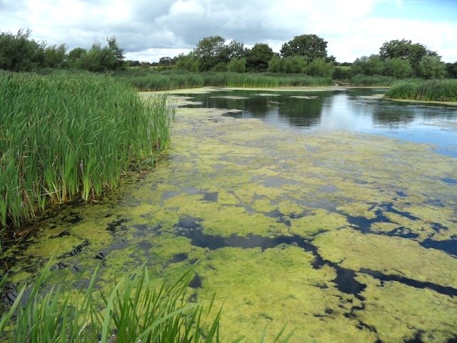
FL5 Eutrophic lakes
View fullsize
![FL6 Turloughs **]()

FL6 Turloughs **
View fullsize
![FL6 Turloughs **]()
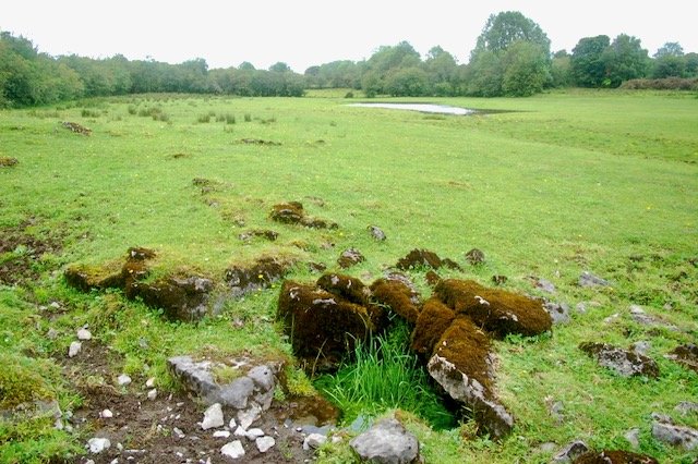
FL6 Turloughs **
View fullsize
![FL7 Reservoirs]()
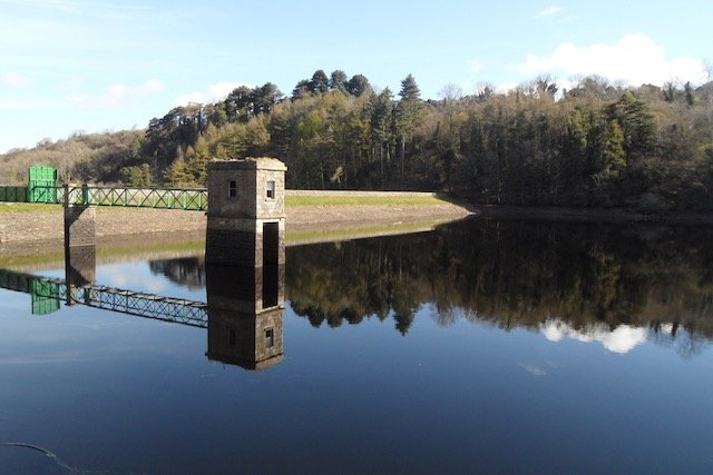
FL7 Reservoirs
View fullsize
![FL7 Reservoirs]()
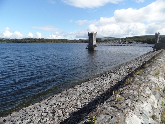
FL7 Reservoirs
View fullsize
![FL8 Other artificial lakes and ponds]()

FL8 Other artificial lakes and ponds
View fullsize
![FL8 Other artificial lakes and ponds.]()

FL8 Other artificial lakes and ponds.
View fullsize
![FS1 Reed & large sedge swamps **]()

FS1 Reed & large sedge swamps **
View fullsize
![FS1 Reed & large sedge swamps **]()
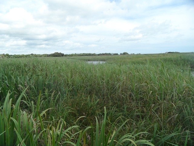
FS1 Reed & large sedge swamps **
View fullsize
![FS2 Tall-herb swamps **]()

FS2 Tall-herb swamps **
View fullsize
![FS2 Tall-herb swamps **]()

FS2 Tall-herb swamps **
View fullsize
![FW1 Eroding/upland rivers]()

FW1 Eroding/upland rivers
View fullsize
![FW1 Eroding/upland rivers]()
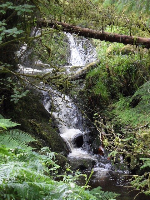
FW1 Eroding/upland rivers
View fullsize
![FW1 Eroding/upland rivers]()

FW1 Eroding/upland rivers
View fullsize
![FW2 Depositing/lowland rivers]()

FW2 Depositing/lowland rivers
View fullsize
![FW2 Depositing/lowland rivers]()
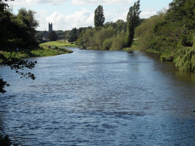
FW2 Depositing/lowland rivers
View fullsize
![FW3 Canals]()

FW3 Canals
View fullsize
![FW3 Canals]()

FW3 Canals
View fullsize
![FW4 Drainage ditches]()

FW4 Drainage ditches
View fullsize
![FW4 Drainage ditches]()

FW4 Drainage ditches
View fullsize
![FP1 Calcareous springs **]()

FP1 Calcareous springs **
View fullsize
![FP2 Non-calcareous springs **]()

FP2 Non-calcareous springs **
View fullsize
![GA1 Improved agricultural grassland]()

GA1 Improved agricultural grassland
View fullsize
![GA1 Improved agricultural grassland]()

GA1 Improved agricultural grassland
View fullsize
![GA2 Amenity grassland]()

GA2 Amenity grassland
View fullsize
![GA2 Amenity grassland]()
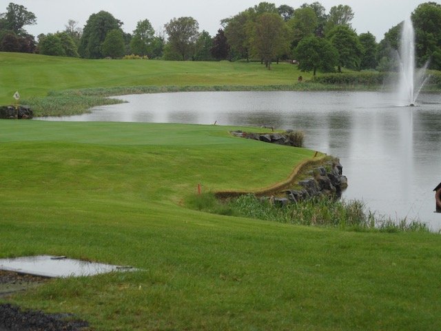
GA2 Amenity grassland
View fullsize
![GM1 Marsh]()

GM1 Marsh
View fullsize
![GM1 Marsh]()

GM1 Marsh
View fullsize
![GS1 Dry calcareous and neutral grassland]()

GS1 Dry calcareous and neutral grassland
View fullsize
![GS1 Dry calcareous and neutral grassland]()

GS1 Dry calcareous and neutral grassland
View fullsize
![GS1 Dry calcareous and neutral grassland]()

GS1 Dry calcareous and neutral grassland
View fullsize
![GS1 Dry calcareous and neutral grassland]()

GS1 Dry calcareous and neutral grassland
View fullsize
![GS1 Dry calcareous and neutral grassland]()

GS1 Dry calcareous and neutral grassland
View fullsize
![GS2 Dry meadows and grassy verges]()

GS2 Dry meadows and grassy verges
View fullsize
![GS2 Dry meadows and grassy verges]()

GS2 Dry meadows and grassy verges
View fullsize
![GS3 Dry-humid acid grassland]()

GS3 Dry-humid acid grassland
View fullsize
![GS4 Wet grassland]()
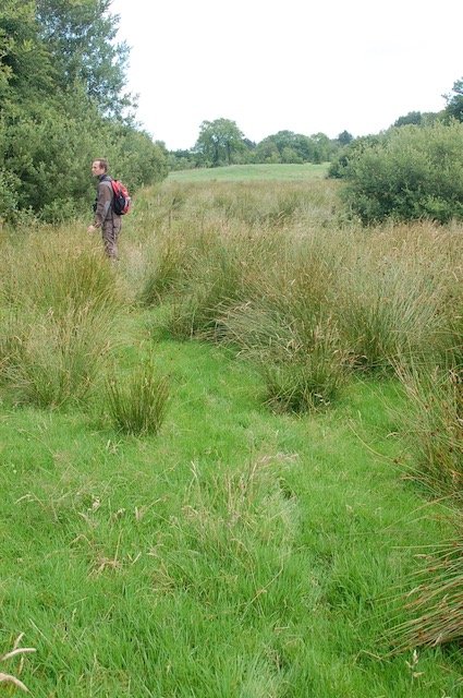
GS4 Wet grassland
View fullsize
![GS4 Wet grassland]()
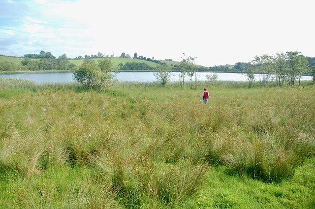
GS4 Wet grassland
View fullsize
![HD1 Dense Bracken]()

HD1 Dense Bracken
View fullsize
![HD1 Dense Bracken]()

HD1 Dense Bracken
View fullsize
![HH1 Dry siliceous heath]()

HH1 Dry siliceous heath
View fullsize
![HH1 Dry siliceous heath]()

HH1 Dry siliceous heath
View fullsize
![HH1 Dry siliceous heath]()

HH1 Dry siliceous heath
View fullsize
![HH1 Dry siliceous heath]()

HH1 Dry siliceous heath
View fullsize
![HH3 Wet heath]()

HH3 Wet heath
View fullsize
![HH3 Wet heath]()
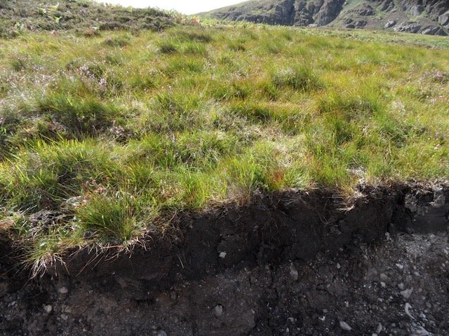
HH3 Wet heath
View fullsize
![HH3 Wet heath]()
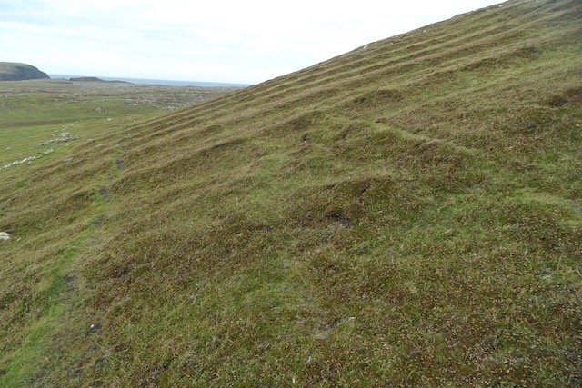
HH3 Wet heath
View fullsize
![HH3 Wet heath]()
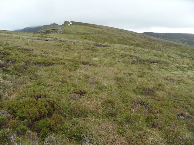
HH3 Wet heath
View fullsize
![LR1 Exposed rocky shores]()

LR1 Exposed rocky shores
View fullsize
![LR1 Exposed rocky shores]()

LR1 Exposed rocky shores
View fullsize
![LR2 Moderately exposed rocky shores]()

LR2 Moderately exposed rocky shores
View fullsize
![LR3 Sheltered rocky shores]()

LR3 Sheltered rocky shores
View fullsize
![LR5 Sea caves]()

LR5 Sea caves
View fullsize
![LS1 Shingle and gravel shores]()

LS1 Shingle and gravel shores
View fullsize
![LS2 Sand shores]()

LS2 Sand shores
View fullsize
![LS2 Sand shores]()

LS2 Sand shores
View fullsize
![PB1 Raised bog **]()
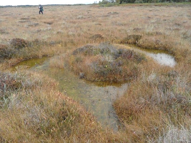
PB1 Raised bog **
View fullsize
![PB2 Upland blanket bog **]()

PB2 Upland blanket bog **
View fullsize
![PB3 Lowland blanket bog **]()
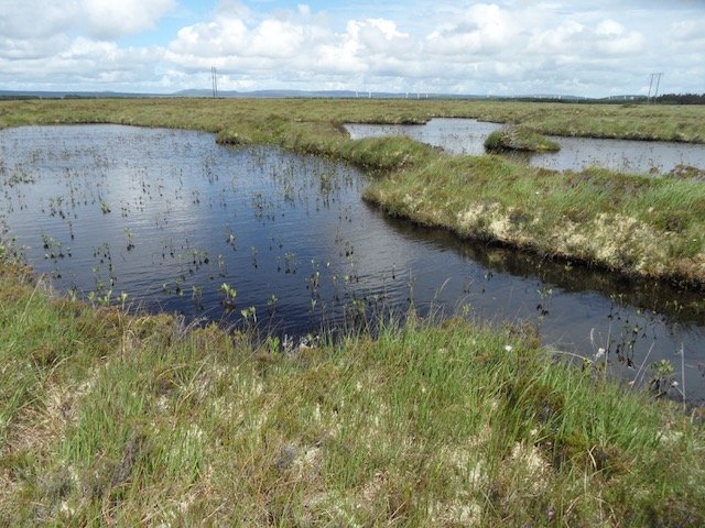
PB3 Lowland blanket bog **
View fullsize
![PB4 Cutover bog **]()

PB4 Cutover bog **
View fullsize
![PB5 Eroding blanket bog **]()

PB5 Eroding blanket bog **
View fullsize
![PF1 Rich fen and flush **]()

PF1 Rich fen and flush **
View fullsize
![PF2 Poor fen and flush **.]()

PF2 Poor fen and flush **.
View fullsize
![PF3 Transition mire & quaking bog **]()

PF3 Transition mire & quaking bog **
View fullsize
![WD1 (Mixed) broadleaved woodland]()

WD1 (Mixed) broadleaved woodland
View fullsize
![WD2 Mixed broadleaved/conifer woodland]()

WD2 Mixed broadleaved/conifer woodland
View fullsize
![WD4 Conifer plantation]()

WD4 Conifer plantation
View fullsize
![WD5 Scattered trees and parkland.]()
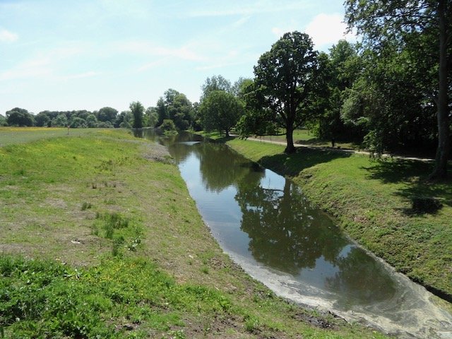
WD5 Scattered trees and parkland.
View fullsize
![WN1 Oak-birch-holly woodland]()

WN1 Oak-birch-holly woodland
View fullsize
![WN1 Oak-birch-holly woodland]()

WN1 Oak-birch-holly woodland
View fullsize
![WN2 Oak-ash-hazel woodland]()

WN2 Oak-ash-hazel woodland
View fullsize
![WN4 Wet pedunculate oak-ash woodland **]()

WN4 Wet pedunculate oak-ash woodland **
View fullsize
![WN5 Riparian woodland **]()

WN5 Riparian woodland **
View fullsize
![WN6 Wet willow-alder-ash woodland **]()

WN6 Wet willow-alder-ash woodland **
View fullsize
![WN7 Bog woodland **]()

WN7 Bog woodland **
View fullsize
![WL1 Hedgerows]()

WL1 Hedgerows
View fullsize
![WL1 Hedgerows]()

WL1 Hedgerows
View fullsize
![WL2 Treelines]()

WL2 Treelines
View fullsize
![WL2 Treelines]()

WL2 Treelines
View fullsize
![WS1 Scrub]()

WS1 Scrub
View fullsize
![WS1 Scrub]()

WS1 Scrub
View fullsize
![WS1 Scrub]()

WS1 Scrub
View fullsize
![WS1 Scrub]()

WS1 Scrub
View fullsize
![WS2 Immature woodland]()

WS2 Immature woodland
View fullsize
![WS3 Ornamental/non-native shrub]()
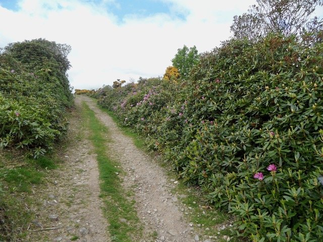
WS3 Ornamental/non-native shrub
View fullsize
![WS4 Short rotation coppice]()
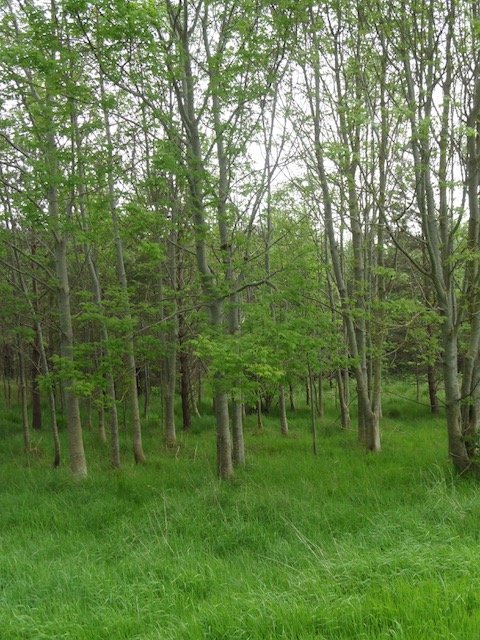
WS4 Short rotation coppice
View fullsize
![WS4 Short rotation coppice]()
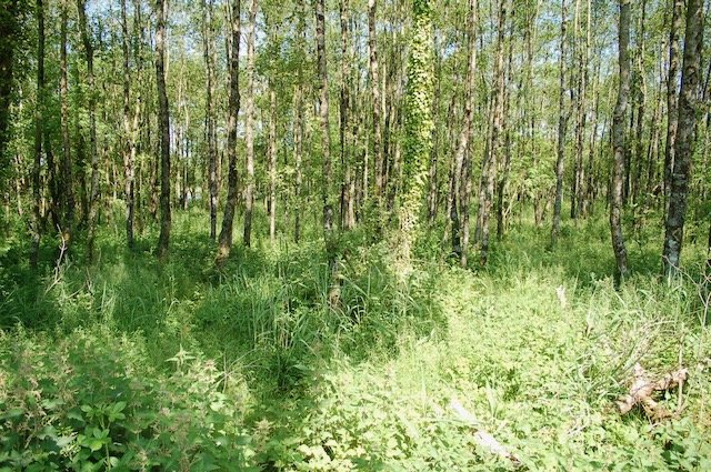
WS4 Short rotation coppice
View fullsize
![WS5 Recently-felled woodland]()

WS5 Recently-felled woodland
View fullsize
![WS5 Recently-felled woodland]()

WS5 Recently-felled woodland
